Location:Switzerland
Elevation: 4,478 meters
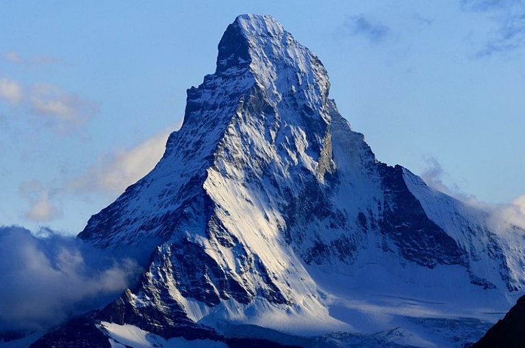
Dubbed as “The Mountain of the Mountains,” Matterhorn, a large rocky, almost-symmetrical pyramidal mountain in Switzerland, is every mountaineer’s dream. They call it Cervino in Italy, and Mont Cervin in France, and probably the most iconic mountain in the entire Swiss Alps.
With an elevation of 4, 478 meters, the mountain is the fifth highest peak in the Alps. It is situated on the Switzerland and Italy border, in the Monte Rosa area of the western Pennine Alps. The mountain dominates the Swiss village of Zermatt, in the German-speaking canton of the Valais, to the northeast, and the Italian alpine resort of Breuil-Cervinia, in the Aosta Valley region, to the south.
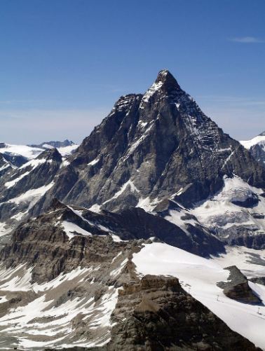
Due to its dangerous and tricky trail, Matterhorn is only visited by almost 3 000 climbers each year but is probably the most photographed mountain in Europe. It is famous for its four picturesque ridges namely; Hörnli, Furggengrat, Liongrat, and Zmuttgrat, which split the mountain into four steep faces that rise above massive surrounding glaciers, pointing to the four compass points. Three of Matterhorn’s faces (north, east, and west) lay on the Swiss side and one (south) on the Italian side.
Climbing the mountain demands exceptional climbing skills and experience and fitness level as the ascent is not like the other mountains in the world. It is much more challenging to climb Matterhorn than the Mt. Everest.
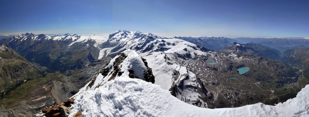
The surrounding region is comprised of lush meadows and pristine landscapes. The scenic beauty, superb lodging, and the ability to challenge oneself by day and live in luxury by night make climbing a remarkable experience in Switzerland.
When is the best time for the climb
Climbers can either pass the Italian or Swiss side to reach Matterhorn, depending on the route you choose.
- Italian Side
Choosing the Italian side, you need to travel to the town of Breuil-Cervinia at Aosta Valley, in the commune of Valtournenche, in the country’s northwest.
It is 30-kilometer travel from the main Aosta Valley motorway accessible by car and public vehicles. Turin Caselle, which is 118 kilometers from Cervinia, is the most convenient airport, followed by Milan Malpensa (160km) and Geneva (210km), offering transfers Cervinia. The nearest train station, Châtillon/Saint-Vincent, and stations in Turin and Milan offer coach service to and from Breuil-Cervinia and regular bus connections.
- Swiss Side
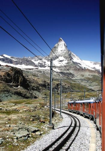
Zermatt will be the starting point of the climb, located in the Valais’ German-speaking canton, in the country’s south. There are International flights at Geneva and Zurich that offers hourly rail connections to Zermatt. Private cars are only allowed until the municipality of Täsch, and the remaining 7 kilometers to the Matterhorn must be traveled by train or a taxi. It will take three to four and a half hours’ drive from Geneva, Zurich or Milan to Zermatt.
When is the best time to climb
In June, warm days come, but it takes some time to clear the winter and spring snow from the climb. However, in some exceptionally warm weather, the latter part of June, the peak can come into reasonable climbing conditions. It is not until mid-July, mid-summer when the sun on the east face is quite warm, vast amounts of snow can melt quite quickly, and make the route more predictably in shape.
The off-season of the climb starts in early September, although there may take some days with nice weather when the sun is lower in the sky and has lost much of its snow melting power. If there will be late summer snow in the peak in the few days of September, might cause that the summit will not return to its condition that year. But if the mountain remains dry, it can be climbed until the first of the fall season snows finally come.
There are inevitable summer storms about 2 to 3 in July and August each year. Today, climbers trek in all faces and ridges of the mountain, but for safety reasons, the best time to do it is in summer, from June to September.
Best Routes
There are several routes and variations to Matterhorn’s summit, but the two most popular routes are Hörnli ridge and Zermatt to Schwarzsee.
Matterhorn’s northeast ridge, the Hörnli ridge, is the usual route from the Swiss side. Departing from the Zermatt about 1, 608 meters, the first climbers in 1865 used the ascent and considered the easiest way to the summit.
On the first day, hikers usually take the lift to Schwarzsee, a small lake about 2, 552 meters located on Matterhorn’s foot, and they will hike nearly two and a half hours uphill to the Hörnli hut.
Meanwhile, mountaineers can directly set off on a 950m-climb from Zermatt to Schwarzsee, which takes about 3 hours. The second day requires a 6-hour sustained climbing to the summit with 1, 700 meters distance, and 1, 200 meter-vertical rise.
Duration of the climb
Guided ascent and descent to Matterhorn takes typically 2 to 3 days, including a mountain refuge climb on the first day, while reaching the summit and returning to the starting point on the second day.
Matterhorn is not to be underestimated, and training is needed before the scheduled ascent. Some people train for at least three to four months, including a progressive ramp-up hike time, distance, and elevation gain to build the trekking-specific conditioning safely and effectively.