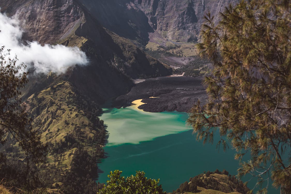
The Hawaiian Islands is home to some of the Earth’s out-of-this-world landscapes. It is not an exaggeration – on one corner, you see recent lava flows stretch mile long, on another, you see huge sea waves slamming on the craggy coastline. Not only that, but the island also boasts sea arches made of limestone, void-like pit craters and cinder-coned hills erected near volcanic vents. The best way to experience these sites is to explore Hawaii Volcanoes National Park, a geographic reserve that offers dramatic volcanic panorama and glimpses of rare flora and fauna.
Geological processes of volcanism, mass wasting, and seismic activities change this place quickly. Frequent ashfalls, earth tremors, strong winds, and heavy rains contribute to creating unique landforms and evolution of unique biological life. On the edge of a volcano grew a lush green rainforest. On its windward side situates a barren, dry, and hot Ka’u Desert. On the park’s shore are jagged cliffs formed by rushing waves where fresh lava flows to meet the sea. Among the numerous native species includes carnivorous caterpillars, weedy invasive plants, and feral pigs. However, most of the intriguing plants and animals are in peril, such as the endangered Hawaiian petrel, hawksbill turtle, and the Mauna Loa silversword.
Two volcanoes frame this national park: Kilauea and Mauna Loa. Kilauea is the youngest volcano in the Hawaiian hotspot. It holds the record of the world’s most active volcano with a near-constant eruption since 1983. In 2018, Kilauea’s month-long volcanic activity destroyed hundreds of homes and sent tons of ash into the air. Adjacent to it is the south eastern slope of the massive Mauna Loa, translated as a long mountain. This silent giant tower 13,677 feet above sea level. When measured from the seafloor, its additional 18,000 feet exceeds Mount Everest in height. Mauna Loa’s slope bulks 19,000 cubic miles in volume, making history’s most massive sub aerial volcano.
Driving a car is the most comfortable option for the volcano tour. There are currently two popular drives to choose from: The Crater Rim Drive Tour and The Chain of Craters Road.
Crater Rim Drive Tour
This is a journey to an 11-mile road on the edge of Kilauea’s caldera leading to viewpoints. Driving through this route will take you the main attractions: the PuuPai Overlook, Devastation Trail, and Kilauea Iki Crater Overlook. There, visitors can gaze into the center of the fiery mountain and smell its pungent sulfur scent.
You can also see the Volcano Center Art Gallery, Volcano House, Sulphur Banks, and the Steam Vents along the drive. The Volcano Center Art Gallery houses local art collections of word carving, painting, pottery, and jewelry. Most displays showcase the rich culture and history of the island. Meanwhile, the Volcano House stood on the hem of Kilauea’s slope and offered a breath-taking view of the park. Some of the house’s notable guests are none other than Mark Twain and President Franklin D. Roosevelt. The Sulphur Banks is a stinky trail that leads to a field covered with bright yellow sulfur deposits. The volcanoes release sulfur gases through the cracks in the earth that will then shift into crystals as they rise. Lastly, the Steam Vents are outlets of belch warm, sulfur-free steam. When rain falls, hot rocks underneath produce warm plumes where people cram around for a free facial.
Chain of Craters Road
This route meanders 20 miles across volcanic landforms between Kilauea and Holei Sea Arch. It is pockmarked with pit craters, petroglyphs, and occasionally, an active lava flow. The crowd favorite for this choice is the night time lava watching. Mile markers along the path include Lua Mano and Ko’oko’olau Craters, HilinaPali Road, Devil’s throat, Mau Loa O Mauna Ulu and the Holei Sea Arch.
Lua Manu Crater is the first-mile marker. It is a pit crater formed when magma below the Earth drains, causing the crust above to collapse. A few miles more reside the Ko’oko’, olau Crater. This crater has not seen lava for over two centuries making its soil fertile for Ohia and Kia trees. On the second mile is the narrow HilinaPali road. This road leads you to the arid environment of the Ka’u Desert. Four miles farther are campground for the Kipuka Nene. However, this ground has been closed as the Nenes (a state bird similar to a Canadian goose) are on the verge of extinction. The next marker is the Devil’s Throat – an unguarded cliff that drops into an abyss. This massive crater ranges 150 feet in width and 165 feet in depth. On the sixth mile is the Mau Loa O Mauna Ulu, where you can see a calm sea of pahoehoe lava. Pahoehoe lava is basaltic lava characterized by a smooth, billowy flow. Fast forward to the last marker is a view to the Holei Sea Arch. This particular sea arch is formed when ancient lava flows, removing weaker rock along the cracks. Every day, the ocean waves crash against the pillar of the arch eroding it more.